
WarBrief Live | October 30, 2026 | Explainers
At a glance
- February 24, 2022: Ukraine closed its airspace to civil traffic — it has not reopened.
- November 24, 2026: Pakistan’s ban on Indian aircraft is next due to expire, at 04:59 local time.
- +3,131 km: the extra distance added to Finnair’s Helsinki–Tokyo route by avoiding Russian airspace, in a university-led study.
- 21h 15m vs 16h 45m: Qantas’s westbound Perth–London journey via Singapore, against the non-stop eastbound flight.
Airspace closures redraw the world’s flight maps. A closure is a government order that bars civilian aircraft from a defined block of sky, usually issued as a NOTAM, a Notice to Air Missions. Airlines must then reroute around it, adding time, fuel and cost — and sometimes changing the journey entirely. This explainer sets out how closures work, who decides them, and what they mean for passengers.
Key Takeaways
- Each state controls its own airspace, so a closure is normally a national decision issued as a NOTAM — not an order from ICAO, the United Nations aviation agency.
- Closures range from hours-long emergency bans to multi-year exclusions: Ukraine’s airspace has been closed to civil traffic since February 24, 2022.
- Reroutes cost real time and fuel — a study of 14 long-haul routes found an extra 23 to 28.5 tonnes of fuel burned per rerouted trip.
- Not every “no-fly zone” touches commercial aviation: Lapu-Lapu City’s October 2026 zone covered drones, kites and balloons, not airliners.
How does an airspace closure actually work?
Under the 1944 Convention on International Civil Aviation, known as the Chicago Convention, each state has sovereignty over the airspace above its territory. When a government decides that airspace is unsafe, its aviation authority issues a NOTAM — a Notice to Air Missions — which defines the affected area, usually by flight information region or geographic boundary, the altitude range, the effective period and the reason. Air traffic control then stops clearing flights into that area, and airlines refile flight plans that avoid it.
Closures arrive in two broad forms. Emergency closures can take effect within minutes or hours, when fighting breaks out, missiles are launched or an airport comes under attack; flights already airborne must divert, sometimes to an alternate airport they never planned to use. Political or long-term closures are announced with days or weeks of notice, giving airlines time to build new standard routes. Ukraine’s closure, issued on February 24, 2022, is the extreme case: a NOTAM closed the entire Kyiv flight information region at all altitudes, and it remains in force.
A closure is not the only way a route disappears. Aviation regulators can advise their own airlines to avoid an airspace even where it has not been formally closed, and those advisories are often more cautious than the NOTAM itself. The European Union Aviation Safety Agency (EASA) does this through Conflict Zone Information Bulletins (CZIBs), which assess risk across a region and recommend avoidance. An airline can also go further than any regulator: if its own security assessment says a route is too risky, it will avoid it regardless of what the NOTAM allows. Insurers play a quieter role in the same decision, because war-risk cover and premiums shape whether operating near a conflict zone is commercially viable at all.
Who decides when airspace closes?
The short answer is the state that controls the airspace. ICAO, the UN agency that sets global aviation standards, does not normally order airlines to stop flying through a member state’s sovereign airspace; it provides the standards and guidance, while states are responsible for warning operators about risks in their own territory and for imposing restrictions when those risks become severe enough. That division of labour is why two neighbouring skies can be treated so differently, and why a formal warning from one country — Ukraine formally notified ICAO in 2026 that it considers Russian airspace increasingly unsafe — is a risk signal rather than a closure in itself.
Other governments then make their own calls. After Russia’s full-scale invasion of Ukraine in 2022, the European Union, the United States, the United Kingdom and others barred Russian aircraft from their airspace, and Russia barred theirs in return — a reciprocal set of bans that reshaped Europe–Asia routing overnight. EASA’s bulletin for Ukraine, CZIB 2022-01, advises EU operators to avoid the entire Ukrainian airspace at all flight levels, and its listing shows the bulletin active with validity running to January 31, 2027. Its bulletin for western Russian airspace similarly warns operators away from several flight information regions, citing the risk that a civilian aircraft could be misidentified by air defences or caught near missile and drone operations, as well as satellite-navigation jamming and spoofing around conflict areas.
For a closer look at how these decisions are coordinated in practice, see the Conflict Zones hub, which tracks the wars and crises behind the closures described here.
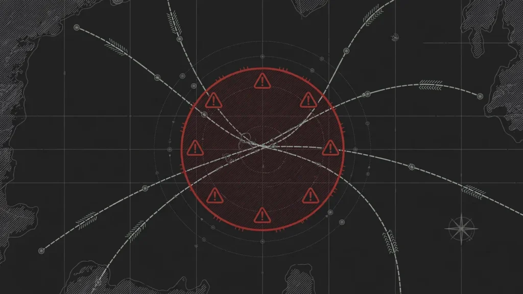
Why do reroutes cost so much time and fuel?
A detour is never just a longer line on a map. The replacement route may be hundreds or thousands of kilometres longer, it may need more fuel than the aircraft can carry with a full payload, and it may push crews past duty limits, forcing an extra stop or an additional crew. It also runs through corridors that suddenly carry everyone else’s diverted traffic, which can mean congestion, delays and higher air-navigation charges on the alternative route. Those costs compound: a route that was marginal before a closure can become uneconomic after it, which is why some services are suspended rather than rerouted.
The Ukraine war provides the clearest measurements. A Dublin City University-led study of 14 long-haul routes operated by Finnair, LOT Polish Airlines and Lufthansa found that rerouted flights burned an extra 23 to 28.5 tonnes of fuel per trip, with operating costs rising by 19 to 39 percent depending on the airline and route. Finnair’s Helsinki–Tokyo service, which once crossed Russian airspace on a near-direct great-circle track, now travels an additional 3,131 kilometres, extending flight times by up to three and a half hours. Finnair, which had built its Asia strategy around the shortest route over Russia, was hit hardest in the study, with operating costs on its Helsinki–Shanghai, Tokyo and Seoul routes up 39 percent and emissions up 40 percent.
The same arithmetic changed one of the world’s most famous routes. Qantas suspended the westbound non-stop Perth–London service in March 2026 after Middle East airspace closures added distance to an already extreme sector, and now operates it via Singapore as flight QF209. Published schedule comparisons put the westbound journey at 21 hours 15 minutes including a 90-minute Singapore stop, against 16 hours 45 minutes non-stop eastbound on QF10 — a difference of four and a half hours between the two directions. The airline has extended the Singapore routing through January 31, 2027, covering the peak Christmas travel season. For passengers, the practical effect is a journey that is longer, less predictable and harder to plan around, even when the airline itself is operating normally.
What do today’s closures look like on a map?
Start in Eastern Europe, where the map has barely changed since 2022. Ukrainian airspace is fully closed to civil traffic, and western Russian airspace is avoided by most European and North American carriers, either by ban or by their own risk assessments — although some carriers from China, the Middle East and elsewhere continue to use Russian airspace on selected routes. The result is a vast detour zone across the north of Eurasia, with Europe–Asia traffic funnelled through Turkey, the Caucasus and Central Asia instead.
South Asia has its own long-running closure, and it is a different kind: a ban aimed at one country’s aircraft rather than a blanket shutdown. Pakistan first barred Indian aircraft from its airspace on April 23, 2025, and has extended the ban month by month since. The latest extension, announced by the Pakistan Airports Authority on October 17, 2026, runs until 04:59 local time on November 24, 2026, according to Dawn and The Hindu. It covers Indian-registered aircraft and aircraft owned, operated or leased by Indian airlines or operators, including military flights, across both the Karachi and Lahore flight information regions. Indian carriers flying west from northern India must therefore swing south around Pakistan, adding time and fuel on Europe, Middle East and North America routes.
The Middle East corridor shows how quickly a usable route can narrow. With Russian and Ukrainian airspace already closed and Iraqi airspace risky, Saudi airspace became one of the few major Europe–Asia corridors left. In October 2026, after Houthi attacks on Saudi airports, reporting described airlines shifting again — this time to Central Asia routes through Georgia, Azerbaijan and Turkmenistan — with Virgin Atlantic’s Mumbai–London service cited as an example of the new routing. The episode illustrates the cascade effect: when one corridor closes, traffic does not spread evenly; it piles into the next available gap, which then carries its own risks, including, on parts of the Central Asia routing, proximity to Afghan airspace where air traffic control is not reliably maintained.
Not every headline “no-fly zone” belongs in the same category. When Lapu-Lapu City in Cebu hosted the ASEAN defence ministers’ meetings from October 26 to 30, 2026, the city declared its entire territory a no-fly zone — but the restriction covered drones, unmanned aircraft, kites, balloons and other remotely controlled flying objects, enforced under a city ordinance with a 5,000-peso fine and confiscation of equipment. Commercial airliners were never the target. The distinction matters for readers: a local drone ban and a state-level airspace closure share a name, not a mechanism, and confusing the two overstates the disruption.
Airspace closures by the numbers
| Metric | Figure | Source |
|---|---|---|
| Ukraine airspace closed to civil traffic since | February 24, 2022 (CONFIRMED) | EASA CZIB listing; Safe Airspace |
| EASA Ukraine bulletin validity | To January 31, 2027 (CONFIRMED) | EASA conflict-zone advisories |
| Pakistan ban on Indian aircraft, current expiry | November 24, 2026, 04:59 local time (CONFIRMED) | Pakistan Airports Authority NOTAM, via Dawn and The Hindu |
| Extra distance, Finnair Helsinki–Tokyo | +3,131 km; up to +3.5 hours (STUDY FINDING) | Dublin City University-led study |
| Extra fuel per rerouted long-haul trip | 23–28.5 tonnes (STUDY FINDING) | Dublin City University-led study of 14 routes |
| Qantas Perth–London westbound vs eastbound | 21h 15m via Singapore vs 16h 45m non-stop (PUBLISHED SCHEDULES) | Published Qantas timetables, October 2026 |
| Lapu-Lapu City drone no-fly zone fine | 5,000 pesos plus confiscation (CONFIRMED) | Lapu-Lapu City advisory, via Cebu Daily News |
Caveat: figures marked CONFIRMED rest on official notices or multiple reputable outlets; study findings and schedule comparisons are labelled as such and describe specific routes, not the whole industry.
What airspace closures mean for US, UK and EU readers
For readers in the United States, the United Kingdom and the European Union, closures rarely mean a flight over their own country is cancelled. They mean the long-haul journey gets longer, dearer and less direct. Europe–Asia flights that once crossed Russia now loop south or north; Gulf-hub connections that once felt routine can be disrupted at short notice when a regional escalation closes several flight information regions at once; and Australia–Europe travellers, as the Qantas example shows, can lose a non-stop service for a whole season. Fares follow costs with a lag: more fuel, more crew time and more expensive routings feed into ticket prices, and capacity lost to suspended routes keeps them there.
The practical advice is unglamorous but effective. Check not only the destination but every transit airport on the itinerary, because a closure at a hub can strand a passenger whose destination is untouched. Keep bookings flexible where the price difference is small, and read the airline’s rebooking terms before a crisis rather than during one. For travel to the Philippines, the Cebu example is a reminder to check local drone and event restrictions too — a rule aimed at hobby aircraft can still affect a photographer’s or surveyor’s plans. And for anyone following the war in Ukraine, the Saudi Arabia flights guide and the Riyadh airport reopening explainer show how airport attacks, as distinct from airspace closures, disrupt travel in the Gulf.
What to watch next on the world’s flight maps
Three dates frame the near term. November 24, 2026 is the next expiry for Pakistan’s ban on Indian aircraft; each monthly renewal has so far extended it, and a lapse — or a further extension — will be announced by NOTAM, not by press conference. January 31, 2027 is the validity limit on EASA’s current Ukraine and western-Russia bulletins, and on Qantas’s Singapore routing; none of those dates is a promise of reopening, but each forces a fresh decision. And in the Gulf, the question is whether the Central Asia detours of October 2026 harden into standard routes or unwind if the Saudi corridor stabilises.
The deeper question is structural. Airspace closures used to be rare, short and local. The closures of the 2020s — Ukraine since 2022, the reciprocal Russia bans, the rolling Pakistan–India ban since April 2025, the repeated Middle East shutdowns of 2026 — are long, layered and overlapping. Airlines have adapted by building detours into standard planning, but every detour narrows the map a little further. The next closure, wherever it falls, will land on a network with less slack than the one it replaced. For background on the country at the centre of the newest example, see the Philippines country profile.
Frequently asked questions
What is a NOTAM?
A NOTAM, or Notice to Air Missions, is an operational notice issued by an aviation authority telling pilots and airlines about a restriction or hazard — including an airspace closure, its boundaries, altitudes and effective times. Airlines receive NOTAMs in their flight-planning systems and must comply with them.
Can my flight be rerouted while it is in the air?
Yes. If airspace closes mid-flight, pilots coordinate with air traffic control to divert around it, which usually means a longer route and a later arrival, and occasionally a diversion to a different airport. Airlines plan alternate airports and extra fuel for exactly this contingency.
Who decides whether my airline avoids an airspace?
The state controlling the airspace decides whether to close it, regulators such as EASA advise their airlines through bulletins, and each airline makes its own security assessment — which can be stricter than any official notice. Insurers’ war-risk terms also influence the decision.
Is a local “no-fly zone” the same as an airspace closure?
No. A city or event no-fly zone, such as Lapu-Lapu City’s October 2026 zone, may cover only drones, kites and balloons. A state-level airspace closure bars civilian aircraft from a defined block of sky. The two share a name but operate at entirely different scales.
How can I tell whether my route is affected?
Check the airline’s own travel alerts first, then the transit airports on your itinerary, and finally official sources such as EASA’s conflict-zone advisories. Flight-tracking maps show the effect — empty skies over a conflict zone — but only the airline can confirm what happens to your booking.
Sources
- Dawn: Pakistan extends airspace ban for Indian aircraft until Nov 24
- The Hindu: Pakistan extends airspace ban on Indian aircraft till November 24
- EASA: Conflict Zones Advisories (CZIB listings for Ukraine and the Russian Federation)
- Safe Airspace: Ukraine airspace risk and closure status
- Caliber / The Conversation study: How war in Ukraine increased flying’s impact on climate
- Executive Traveller: Qantas extends new routes to London, Paris via Singapore
- Chosun Biz: Houthi strikes push Europe–Asia flights to Central Asia routes
- Cebu Daily News: Lapu-Lapu imposes no-fly zone for ASEAN defense meetings


Discussion 0
Share analysis, corrections, or context. Be civil — comments are moderated.