WarBrief Live | October 7, 2026 | OSINT Explained
Open-source intelligence (OSINT) lets anyone with an internet connection track commercial ships — and that is exactly how to track ships with OSINT to expose the so-called shadow fleet moving sanctioned oil around the world. Free tools such as MarineTraffic broadcast live vessel positions picked up from AIS transponders, satellite data fills in the gaps when ships switch their transponders off, and public records tie anonymous tankers to their owners. In recent weeks, these techniques have revealed how sanctioned tankers moved more than 176,000 tonnes of fuel from South Korean ports to Russia.
Key Takeaways
- AIS transponders broadcast every large commercial ship’s identity, position, speed and heading — and the signal is free to read.
- Free OSINT tools including MarineTraffic, Global Fishing Watch and Copernicus satellite data let anyone follow vessels worldwide.
- Shadow-fleet tankers try to evade tracking by switching off AIS, spoofing positions and rotating flags — analysts call this “dark activity”.
- OSINT investigators exposed a seven-tanker fuel run from South Korea to Russia, including three already-sanctioned vessels.
- Anyone can learn these methods — they use only public data and free tools, with no hacking required.
What is AIS, and how does ship tracking actually work?
The backbone of ship tracking is the Automatic Identification System, or AIS. Every passenger ship and every internationally voyaging ship of 300 gross tonnage or more has been required to carry an AIS transponder since 2004. The transponder continuously broadcasts the vessel’s identity — name, MMSI and IMO numbers, callsign, flag, size and type — along with its position, speed and heading, to nearby ships, coastal receiver stations and satellites.
AIS was designed as a collision-avoidance system, not a surveillance network. Crucially for investigators, the signal is unencrypted and openly receivable. Shore stations pick up the broadcasts of nearby vessels, while satellite AIS receivers fill in the mid-ocean gaps. That open design is precisely why governments, trade organisations, emergency services and — increasingly — journalists and hobbyists can all read the same data.
There is a catch that shadow-fleet operators exploit: because AIS was never built to be secure, the signal can be switched off entirely or manipulated. Global Fishing Watch notes that the system “is designed to be open and is not encrypted, making it easy to manipulate data … or be switched off completely”. Understanding that fragility is the first step in learning how to track ships with OSINT — because the gaps in the data are often the most revealing part.
Which free OSINT tools can track ships?
The most widely used free tool is MarineTraffic, which shows live positions for more than 350,000 vessels per day and port arrivals and departures across over 21,000 ports. You can search by vessel name, flag, type, IMO number or MMSI, and the free tier covers the core tracking features — satellite AIS is the paid upgrade. Similar free AIS aggregators include VesselFinder and Ship Finder, which display a vessel’s name, position, MMSI and navigational status.
Global Fishing Watch is a free interactive map of vessel movements built from AIS and satellite data. Basic access requires no account, and although it was founded in 2015 by Oceana, SkyTruth and Google to monitor fishing, its movement data is useful for any vessel-tracking investigation. When ships go fully dark, Sentinel-1 radar imagery from the EU’s Copernicus programme offers free satellite data that can detect large vessels regardless of their transponder status.
Investigators layer these trackers with public registries: Equasis for vessel ownership and inspection history, the free sanctioned-vessel databases FleetLeaks and the UANI Ghost Armada list, and official designations from the US Treasury’s OFAC and the EU. Cross-referencing a vessel’s name, IMO number, flag and ownership across these sources is what turns raw AIS data into real OSINT. For more techniques, see our companion OSINT tool guides.
What does it mean when a ship goes dark on AIS?
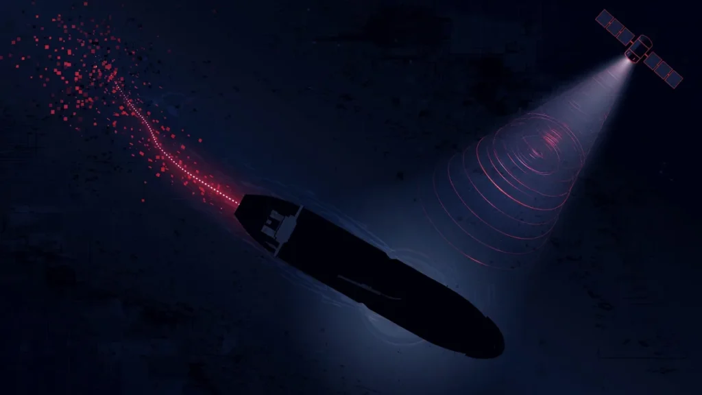
When a vessel’s AIS signal disappears, analysts call it “dark activity” — the signature behaviour of the shadow fleet. Documented evasion techniques include switching off the transponder before ship-to-ship transfers and reappearing hours later in a different position, broadcasting fake voyage details, impersonating legitimate ships from neutral nations, and rotating flags through convenient registries such as St Kitts, Gabon, the Cook Islands, San Marino and Palau. Ownership is typically hidden behind single-ship shell companies registered in closed registries.
The scale of the problem is growing. The UN Office on Drugs and Crime’s 2025 maritime crime report recorded a 300 percent increase in AIS anomalies in the Gulf region since 2023. But a missing signal is not, on its own, proof of sanctions evasion: transponders can fail mechanically, captains legitimately switch them off in piracy-prone waters, and naval vessels operate dark as a matter of course. Professional investigators treat dark activity as a lead to corroborate with satellite imagery, port records and ownership data — never as a conclusion.
How OSINT exposed Russia’s secret South Korea fuel run
On October 6, 2026, Reuters reported a textbook case of OSINT in action. More than 176,000 tonnes of petroleum products, mostly diesel, were shipped from South Korean ports to Russia in July and August 2026 aboard seven tankers making fourteen voyages. Three of the tankers were already under UK or EU sanctions, and the shipments accounted for 31 percent of Russia’s fuel imports in August.
Investigators named the vessels: the sanctioned tanker Layla, which moved 57,000 tonnes of diesel from Ulsan to Vladivostok while twice declaring other destinations; the Astoria, carrying about 11,000 tonnes; and the Chongchon, which loaded roughly 26,000 tonnes via a ship-to-ship transfer off Yeosu. Ukraine’s sanctions commissioner Vladyslav Vlasiuk said the shipments began as Ukrainian drone strikes were cutting into Russian refinery output, pushing Moscow into a domestic fuel crisis severe enough that Russia banned diesel and gasoline exports.
The method behind the reporting is pure OSINT: AIS tracks showing the tankers’ real movements, port records contradicting their declared destinations, satellite imagery confirming the transfers, and sanctions lists flagging three of the seven hulls. It is the same toolkit that lets analysts follow the war at sea — from the recent Black Sea strikes on commercial vessels to the surge in tanker attacks in the Strait of Hormuz.
By the numbers: the shadow fleet
| Metric | Figure | Source |
|---|---|---|
| Shadow-fleet vessels worldwide (Sept 2026) | More than 1,300 — about 1 in every 5 oil tankers | Chatham House |
| Ships sanctioned by the EU | ~600 | EU, via Brussels Signal |
| Russia’s seaborne oil moved by shadow tankers (Aug 2026) | 52% | CREA |
| Shadow vessels sailing under false flags (end of Aug 2026) | 45 | AFP, via Brussels Signal |
| Fuel from South Korea to Russia (Jul–Aug 2026) | 176,000+ tonnes, 7 tankers, 14 voyages | Reuters |
| Russia’s seaborne fuel imports (Aug 2026) | ~368,000 tonnes, highest since Feb 2022 | Azernews via Guardian — REPORTED |
| AIS anomalies in the Gulf since 2023 | +300% | UNODC 2025 report via Archyde — REPORTED |
| Tankers seized in first eight weeks of 2026 | 9 | energyandcapital — REPORTED |
Figures marked CONFIRMED in the first five rows rest on two or more reputable sources; rows marked REPORTED rely on a single outlet chain or one analyst estimate. Shadow-fleet totals vary because analysts count different vessel categories.
What this means for US/UK/EU readers
Ship tracking matters to Western readers because it is how sanctions get enforced — or evaded. With the Graham Act’s October 18 sanctions deadline approaching, the US is preparing secondary tariffs on buyers of Russian energy and new penalties on the vessels, ports and insurers that move it. Every shadow-fleet tanker identified by OSINT is a potential enforcement target, which is why investigators publish their findings openly.
There is also a direct household angle. Russia’s fuel crisis, Ukrainian strikes on refineries and the rerouting of sanctioned cargo all feed through to global diesel prices, freight rates and the war-risk surcharges added to cargoes through contested waters. If you drive a diesel vehicle, buy heating oil or run a business that moves goods, the dark tracks on an AIS map are quietly shaping your fuel bill. For the full sanctions picture, see our sanctions hub.
What to watch next
Three things are worth following. First, the October 18 deadline under the Graham Act will test whether the US imposes the promised penalties on shadow-fleet vessels and their insurers. Second, attacks on commercial shipping are spreading: the October drone strikes inside Bulgaria’s exclusive economic zone show that even NATO waters are no longer off-limits, raising the stakes for commercial traffic in the Black Sea. Third, enforcement is escalating at sea — nine tankers were seized in the first eight weeks of 2026, including the Tagor, boarded by the French navy west of Brittany.
For readers who want to dig deeper, the tools described here are free and legal: open MarineTraffic, search a vessel name from any sanctions list, and watch the dark gaps appear for yourself. For the broader maritime conflict picture, browse our conflict zones hub.
Frequently asked questions
How does MarineTraffic work?
MarineTraffic collects AIS radio signals broadcast by ships — identity, position, speed and heading — through coastal receiver stations and satellites, then displays the positions on a live map. You can search for a vessel by name, port, area, IMO number or MMSI and filter by vessel type. Governments, trade organisations, emergency services, maritime professionals and hobbyists all use it, and the core tracking features are free.
What does it mean when a ship goes dark on AIS?
It means the vessel’s AIS transponder has been switched off or its signal is being spoofed. Shadow-fleet tankers routinely go dark before ship-to-ship transfers, then reappear hours later in a different position, sometimes under a different name or flag. Dark activity is a red flag for sanctions evasion, but it is not proof on its own — equipment can fail, and ships may go dark to avoid pirates.
Can you track any ship with AIS?
Only vessels that are broadcasting. Warships and sanctioned tankers routinely run dark, and smaller vessels are not required to carry AIS at all. Free radar satellite imagery, such as Sentinel-1 data from the EU’s Copernicus programme, is the fallback for detecting AIS-dark vessels, though it cannot identify them the way a transponder can.
Is it legal to track ships with OSINT?
Yes. AIS broadcasts are intentionally public and unencrypted, AIS aggregator data is published openly, and port records, satellite imagery and sanctions lists are all public information. Tracking ships with OSINT uses no hacking and breaks no laws; it is the same method journalists, insurers and sanctions enforcers use every day.
Sources
- Reuters: South Korea exports eased Russia fuel crisis caused by drone strikes, Ukraine says
- Chatham House: Will the oil tanker shadow fleet ever be brought back in line?
- Brussels Signal: What is Russia’s shadow fleet and how does it work?
- oxint.io: Tracking Russia’s shadow fleet tankers
- hormuz-tracker: Military OSINT sources and free ship-tracking tools
- Archyde: Tracking the global ghost fleet — spoofing and maritime security