
WarBrief Live | November 20, 2026 | Shipping & Logistics
225 m
of road span collapsed into the strait, satellite imagery shows
120 m × 8 m
the shipping channel now blocked by bridge rubble
3 strikes
on the bridge in four days, 16–19 November
1 of 2
rail tracks running again; the road span stays closed
Three Ukrainian strikes in four days have shut the Kerch Bridge, blocked the only shipping channel between the Black Sea and the Sea of Azov, and forced Crimea’s occupation authorities to run free passenger ferries from 20 November — a service already suspended on its first day by bad weather.
This is the Kerch Bridge ferry disruption explained: what the strikes did to the bridge, why the shipping channel is blocked, what the ferries can and cannot carry, and what the closure means for Black Sea shipping, Crimean supply lines and insurance costs. Our account of the attacks themselves covers how Ukraine broke through the bridge’s defences; this article covers what happens now that the crossing is broken.
Key Takeaways
- The road span of the Kerch Bridge collapsed into the Kerch-Yenikale Canal on 17 November; satellite imagery shows about 225 metres of the northern road span down, and the 120-metre-wide, 8-metre-deep shipping channel is blocked by rubble.
- Trains resumed on one of the bridge’s two tracks on the afternoon of 19 November, hours after Neptune missiles hit the rail section. The road span has no reopening date.
- Free passenger-only ferries between Port Krym in Kerch and Port Kavkaz on the Taman Peninsula were due to start on 20 November — but the service was suspended the same day by storms, with wind gusts of 22 metres per second.
- The closure cuts off the Sea of Azov from the Black Sea: ports at Mariupol and Berdyansk, river ports on the Don and Volga, and small Russian naval vessels can no longer transit the strait.
- Moscow says some bridge sections could reopen within one to two months. President Vladimir Putin has said there will be no “energy truce” talks after the bridge strikes.
What happened to the Kerch Bridge this week?
The bridge was hit three times in four days. On the morning of 16 November, Ukrainian drones struck the road section’s steel arch, leaving it listing about 15 degrees to the north-east, according to The Maritime Executive. A second wave overnight into 17 November — about 15 strikes, according to The New Voice of Ukraine — brought the road span and its arch down into the channel. The third strike came overnight into 19 November, when Ukrainian Neptune missiles hit the railway section near the arch.
Ukraine’s Security Service said it had spent more than a month preparing the multi-stage operation, and President Volodymyr Zelenskyy said the strike was a response to Russian attacks on Ukrainian infrastructure. The 19-kilometre bridge, built after Russia seized Crimea in 2014, opened to road traffic in 2018 and to passenger rail in 2019. It has been the main artery carrying fuel, ammunition, military equipment and personnel to the peninsula and on into southern Ukraine, according to Ukraine’s General Staff.
The human cost reported so far is small but real: Sergei Aksyonov, the Russian-installed head of Crimea, reported two deaths after the strikes. What investigators have confirmed, and what remains unverified: the collapse of the road span and the halt to road traffic are confirmed by satellite imagery and by Russian officials themselves; the full extent of the damage to the rail section is still being assessed, and no independent engineering assessment has been published.
Why is the shipping channel blocked?
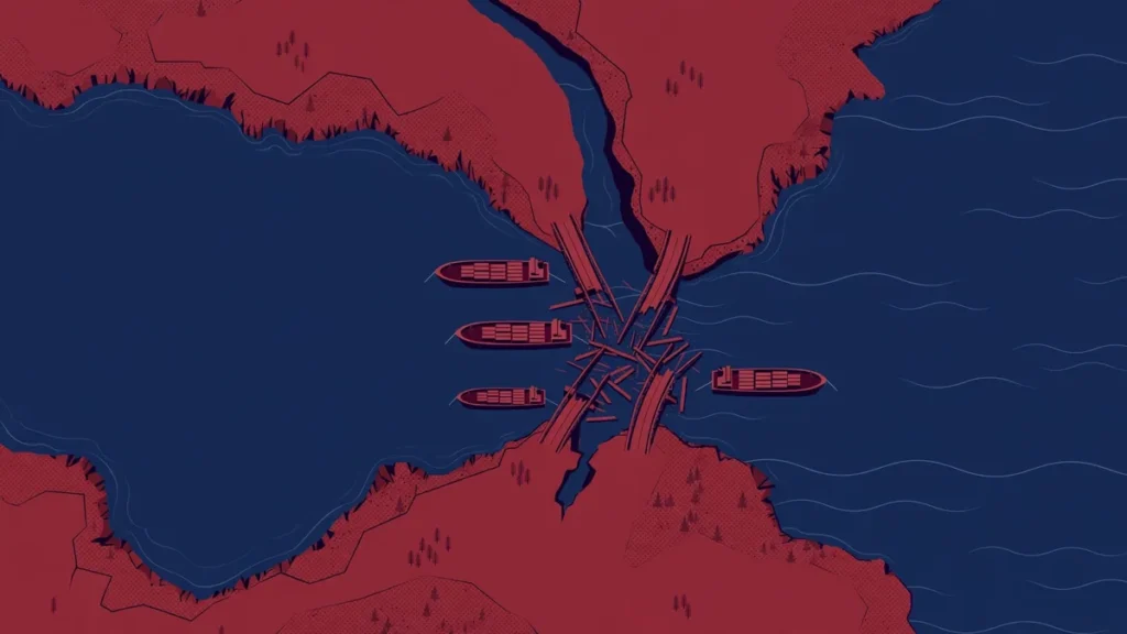
The answer is geography. The Kerch Strait is 4.5 kilometres wide at its narrowest point, but the navigable fairway — the Kerch-Yenikale Canal — is only about 120 metres wide and 8 metres deep, according to the Centre for Global Studies Strategy XXI, quoted by Interfax-Ukraine. The collapsed road span fell directly across that channel. The Maritime Executive reports that the rubble fully blocks the narrow navigation channel and that there are no practical alternatives to move ships under other sections of the bridge.
Satellite imagery taken on 19 November by Vantor’s WorldView-1 satellite, published by The War Zone, showed at least two and possibly three impact points on the rail span, with damage appearing limited to one of the two sets of tracks, and about 225 metres of the northern road span collapsed or partly underwater. One outlet put the collapsed section at 270 metres; the satellite figure of about 225 metres is the more conservative, directly observed number, and this article uses it.
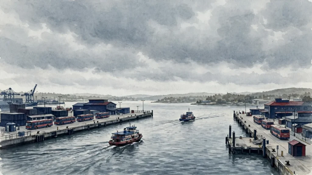
Shipping has stopped on either side of the blocked strait, with vessels held at anchor — and, as The Maritime Executive notes, any accumulation of vessels at anchor in the region offers a target-rich environment for Ukrainian drones, which have damaged or destroyed more than 100 Russian coastal vessels in recent months.
By the numbers
| Metric | Figure | Source |
|---|---|---|
| Road span collapsed | ~225 metres (satellite imagery) | TWZ / Vantor WorldView-1 |
| Shipping channel | 120 m wide × 8 m deep, blocked | Interfax-Ukraine / Strategy XXI |
| Strikes on the bridge | 3 in four days (16, 17, 19 Nov) | CONFIRMED — Ukrainian General Staff, Russian officials |
| Rail service | Resumed on 1 of 2 tracks, 19 Nov | CONFIRMED — Russian Transport Ministry, AP |
| Ferry service start | 20 November, passengers only | CONFIRMED — occupation authorities via NV / RBC-Ukraine |
| First-day ferry status | Suspended — storms, gusts 22 m/s, waves 1.2 m | CONFIRMED — RBC-Ukraine |
| Deaths reported | 2 | REPORTED — Aksyonov, Russian-installed head of Crimea |
| Russian drones claimed downed | 1,336 | REPORTED — Russian claim, 19 Nov |
| Reopening estimate | Some sections in 1–2 months | REPORTED — Deputy PM Marat Khusnullin |
Caveat: figures marked CONFIRMED are carried by at least two sources; figures marked REPORTED rest on a single source or an official claim and should be treated as provisional.
What are the free ferries — and will they run?
With the road span down, Crimea’s occupation authorities announced free passenger boat services across the Kerch Strait from 20 November. Oleg Kryuchkov, an adviser to the Russian-appointed head of Crimea, told the Crimea 24 channel that passengers would be taken by bus to the Port Krym terminal in Kerch, cross by boat to Port Kavkaz on the Taman Peninsula, and then continue by bus to Krasnodar or Taman. The boats carry passengers only — no private vehicles — and carrying petrol in canisters is banned.
The catch is the weather. Kryuchkov warned that boat services depend on conditions and that storms could force crossings to be suspended several times a week. That warning was tested immediately: on 20 November, the day the service was due to start, ferry operations were suspended because of bad weather, with wind gusts reaching 22 metres per second and waves of 1.2 metres, according to RBC-Ukraine. A ferry that cannot sail in a November storm is a fragile substitute for a bridge.
The ferries also cannot carry freight. Trucks and fuel tankers must use the land corridor through Russian-controlled southern Ukraine — a route Ukrainian forces have also hit and degraded. The Maritime Executive reports the strike was designed to push Crimea-bound Russian truck convoys north, within range of the front line and Ukrainian drones. In Simferopol, residents have been stocking up on food and fuel, and demand at petrol stations in Sevastopol has risen, according to RBC-Ukraine.
What the closure means for Crimea’s supply lines
The bridge carried the bulk of Crimea’s road and rail supply. With the road span gone and only one rail track running, the peninsula’s logistics now depend on a single damaged railway, a weather-prone passenger ferry, and a land corridor under fire. Russia’s Transport Ministry said rail traffic resumed on one track on 19 November and that repair work was under way on the second; the first train, Tavria No. 92/91 from Moscow to Kerch, departed Taman station the same day.
Deputy Prime Minister Marat Khusnullin, who chaired a government commission on the damage on 17 November, said some sections of the bridge could reopen within one to two months and that a fuller assessment would be ready within a week. That is an official estimate, not an engineering verdict — no independent assessment has been published, and Ukrainian experts cited by Ports Europe say repairs could take many months, especially in winter. The Institute for the Study of War records that the Russian Ministry of Transport suspended rail and road traffic after the 17 November strikes and later resumed traffic along one railway track.
The political fallout is already visible. Speaking in Shenzhen on 19 November, President Putin said that after the strikes on the Crimean Bridge “there will be no agreements” and that Russia’s response would be “far more painful” — effectively ending talk of an “energy truce” with Ukraine. Hours later, Russia launched its heaviest overnight barrage of the war on Kyiv, covered in our report on the Kyiv strikes.
What the Kerch Bridge closure means for US/UK/EU readers
For most readers in the US, UK and EU, the direct impact is on prices and insurance rather than on daily life. The Sea of Azov is cut off from open water: ports at Mariupol and Berdyansk, which load steel, coal and grain, cannot move cargo until the channel is dredged or a transit route is found. The closure also reaches far inland — river ports on the Don and Volga, and oil products from the Middle Volga, Kama and Don rivers, can no longer reach the sea by river-sea vessels, according to Mykhailo Honchar of the Centre for Global Studies Strategy XXI. Russian Railways, he noted, will not be able to handle all of the diverted cargo.
The insurance market had already priced in the risk. A week before the strikes, CMA CGM added a $35 Black Sea war risk surcharge on cargo, and on 16 November the tanker BETUL 8 was hit by drones and sank off Bulgaria. War risk premiums for Black Sea shipping are likely to stay elevated while the channel is blocked, and grain and energy traders will watch whether the disruption tightens regional supply. Small vessels of Russia’s Black Sea Fleet and Caspian Flotilla can also no longer transit between their bases at Novorossiysk and Kaspiysk — a naval consequence that matters to NATO planners watching the Black Sea. For background on how sea mines and shipping risks interact in another chokepoint, see our explainer on naval mines in the Strait of Hormuz; for the wider energy picture, see our report on Ukraine’s campaign against Russian oil refining.
What to watch next in the Kerch Strait
Five things will decide how long this disruption lasts. First, whether the ferries actually sail: the first day’s weather suspension shows how thin the fallback is, and the strait’s November storms will test it several times a week. Second, the Russian government’s damage assessment, due within a week, and whether the one-to-two-month reopening estimate survives contact with the engineers. Third, whether the second rail track returns to service — that determines how much freight Crimea can still receive by rail.
Fourth, whether Ukraine strikes the bridge again or targets the ferry and the land corridor, and whether Russia’s promised “far more painful” response escalates the campaign against Ukrainian energy infrastructure. Fifth, the shipping market: whether insurers raise Black Sea war risk rates further, and whether grain and oil cargoes from the Sea of Azov find alternative routes or simply stop moving. For continuing coverage, see the WarBrief conflict zones hub.
Frequently asked questions
Is the Kerch Bridge closed?
The road span is closed after collapsing into the strait on 17 November, with no reopening date. Rail traffic resumed on one of the bridge’s two tracks on the afternoon of 19 November. Free passenger ferries across the strait were due to start on 20 November but were suspended the same day by storms.
Can ships still pass between the Black Sea and the Sea of Azov?
No. The collapsed road span blocks the Kerch-Yenikale Canal, the only navigable channel between the two seas. The channel is about 120 metres wide and 8 metres deep, and the rubble sits directly across it. Shipping has stopped on both sides of the strait.
Are the Kerch ferries free?
Yes, for passengers. The boats run between Port Krym in Kerch and Port Kavkaz on the Taman Peninsula, with bus transfers at both ends. They do not carry private vehicles, and passengers may not carry petrol in canisters. Services depend on the weather and can be suspended several times a week.
When will the Kerch Bridge reopen?
There is no firm date for the road span. Deputy Prime Minister Marat Khusnullin said some sections could reopen within one to two months, with a fuller damage assessment due within a week. Ukrainian experts cited by Ports Europe say repairs could take many months, especially in winter.
Why does the Kerch Bridge closure matter for grain and oil?
The Sea of Azov ports of Mariupol and Berdyansk export steel, coal and grain, and river ports on the Don and Volga depend on the strait to reach the Black Sea. With the channel blocked, those cargoes cannot move by sea, and rail cannot absorb all of the diverted traffic. War risk insurance for Black Sea shipping was already rising before the strikes.
Sources
- The Maritime Executive: Kerch Strait Bridge Strike Cuts Off Sea of Azov Shipping
- The New Voice of Ukraine: Crimean occupation authorities to resume Kerch Strait ferry crossings
- RBC-Ukraine: Crimean Bridge damaged again as Russia prepares alternative routes
- Gulf News: New Attack on Crimea Bridge Halts Traffic Amid Rising Tensions
- Institute for the Study of War: Russian Offensive Campaign Assessment, Nov 17, 2026
- Interfax-Ukraine: Kerch Bridge strike to disrupt Russian shipping long-term – expert
- Ports Europe: Destroyed Kerch bridge blocks Azov Sea, Don and Volga rivers ports


Discussion 0
Share analysis, corrections, or context. Be civil — comments are moderated.